Product Details
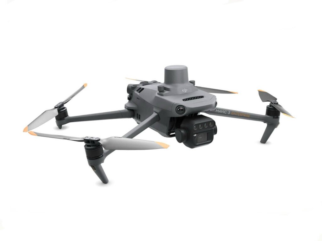
HBC MAVIC 3M
Effective aerial surveying needs to see the invisible. That’s why Mavic 3 Multispectral has two forms of sight. It combines an RGB camera with a multispectral camera to scan and analyze crop growth with total clarity. Agricultural production management requires precision and data, and Mavic 3M delivers both.
Compact and portable
Foldable for easy storage
Multispectral Camera
4 × 5MP
G/R/RE/NIR
RGB camera
20 MP
4/3 CMOS, mechanical shutter
Safe and stable
Omnidirectional Obstacle Avoidance [1]
15km Transmission Distance [2]
Precise positioning
Centimeter-level RTK positioning
Microsecond-level time synchronization
Efficient aerial surveying
Up to 200 hectares per flight
Multispectral + RGB imaging system
Highly integrated imaging system
Newly upgraded imaging system with one 20MP RGB camera and four 5MP multispectralcameras (green, red, red edge, and near infrared). Enables applications such as highprecision aerial surveying, crop growth monitoring, and natural resource surveys.
RTK module
Accurate images that capture every pixel
Mavic 3M with RTK module for centimeter-level positioning. Flight control, the camera, and the RTK module sync in microseconds to accurately capture the location of each camera’s imaging center. This enables Mavic 3M to do high-precision aerial surveying without using ground control points.
Efficient and reliable battery life
Ultra-long battery life, fast bursts
43 minutes
Cruise time
200 hectare
A single flight can complete mapping operations over an area of 200 hectares.
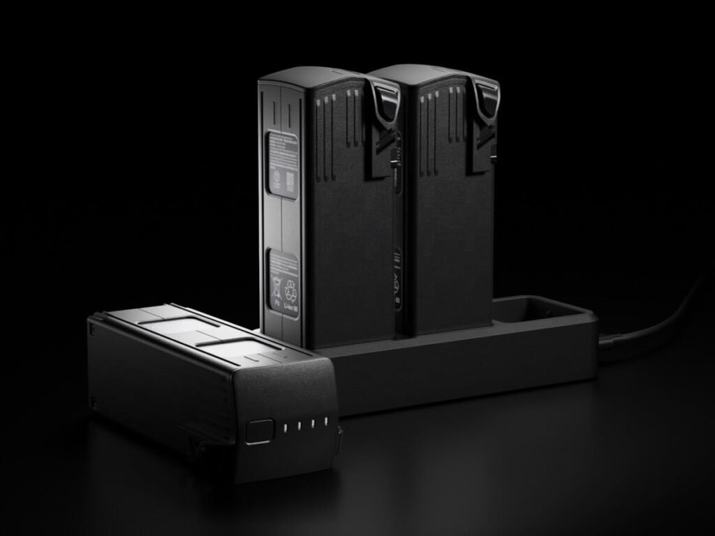
Fast charging
100W Battery Charging Hub
High-efficiency fast charging
88W fast charging
Stable signal, smooth image transmission
The O3 transmission integrates two transmitting signals and four receiving signals to support 15km ultra-long transmission distances.
Omnidirectional obstacle sensing , terrain-follow aerial surveying
The aircraft features multiple wide-FOV vision sensors that accurately detect obstacles in all directions for omnidirectional obstacle avoidance. The terrain-follow aerial surveying can be easily performed in steep-slope landscapes.
Why Global B2B Clients Choose Us
Professional Solutions, Real-World Proven.
Reliable Quality, Trusted Performance.
Factory Direct: Save 30% Instantly.
Plug & Play Expand Any DJI Drone.